")
support@meisterdrucke.com · 0043 4257 29415


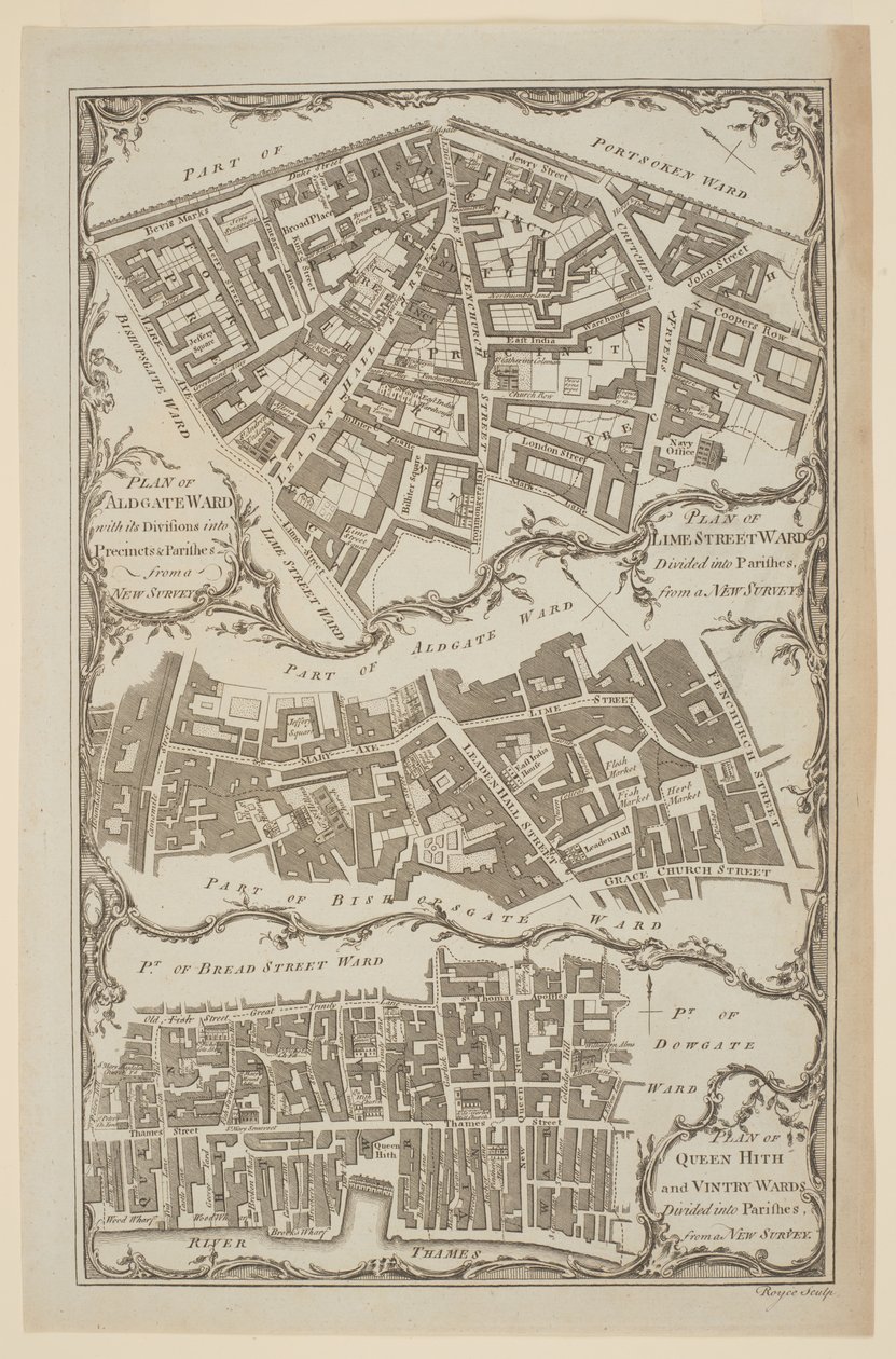
'Plán Queen Hith a Vintry Wards rozdělených do farností z Nového průzkumu'. Mapa City of London od Royce ukazuje Leadenhall Street a East India House('Plan of Queen Hith and Vintry Wards divided into Parishes from a New Survey'. Map of the City of London by Royce showing Leadenhall Street and East India House)English School |
|
€ 139.97
Enthält 21% MwSt.
|
|
Nedatováno · engraving
· ID obrazu: 1425882
British Library, London, UK / Bridgeman Images |
| 0 Recenze |


.jpg "Kostel a chata s osvětlenými okny")
.jpg "Nonpareil s portréty královny Viktorie a prince Alberta")
.jpg "Žena bije svého manžela botou")
.jpg "Portrét kulturisty, kolem roku 1898")
.jpg "Anglická růže")
.jpg "Anglická růže")
.jpg "Lavater Lee and Sons, akrobaté")
.jpg "Muž „Silent Highway“, „Vaše PENÍZE nebo váš ŽIVOT“, karikatura z filmu „Punch, nebo Londýn Charivari“, 10. července 1858")
.jpg "Velká zelená rosnička")
_-_(MeisterDrucke-1008944).jpg "Slon (barevné rytí)")
.jpg "Princes Street Edinburgh – West End")
.jpg "Roman Augurs")
.jpg "Pohled na Akropoli v Aténách")
.jpg "Přijíždějící lodě")
_-_(MeisterDrucke-1421446).jpg "Mapa Evropy v roce 1910 (barevné lito)")
.jpg "Saturn požírá svého syna")
.jpg "Přístavní světlo")
.jpg "Křik")
.jpg "Shinshū Suwa-ko")
_-_(MeisterDrucke-82973).jpg "Rytíř, Smrt a ďábel, 1513 (mědirytina)")
.jpg "Měsíční svit nad Lucernským jezerem na pozadí")
.jpg "Upír")
.jpg "Věž modrých koní, 1913")
.jpg "Dívky")
.jpg "Křídové útesy na Rujáně")
.jpg "Barevné listí v chrámu Kaianji, 1837-1844")
.jpg "Akvarel číslo 606")
.jpg "Obraz z hrobky potápěče z jižního hřbitova v Paestum, 480-470 př.nl")
.jpg "Baku agitační panel, 1927.")
.jpg "Hvězdná noc, červen 1889")